
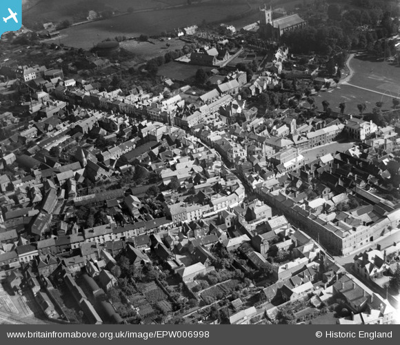
EPW006998 ENGLAND (1921). The High Street and environs, Leominster, 1921
© Hawlfraint cyfranwyr OpenStreetMap a thrwyddedwyd gan yr OpenStreetMap Foundation. 2026. Trwyddedir y gartograffeg fel CC BY-SA.
Delweddau cyfagos (7)
EPW006998

 0°
0m
0°
0m
EPW006996
 29°
47m
29°
47m
EPW005065
 109°
127m
109°
127m
EPW005064
 189°
216m
189°
216m
EPW005063
 259°
222m
259°
222m
EPW006997
 50°
237m
50°
237m
EPW005062
 48°
327m
48°
327m
Manylion
| Pennawd | [EPW006998] The High Street and environs, Leominster, 1921 |
| Cyfeirnod | EPW006998 |
| Dyddiad | 31-August-1921 |
| Dolen | |
| Enw lle | LEOMINSTER |
| Plwyf | LEOMINSTER |
| Ardal | |
| Gwlad | ENGLAND |
| Dwyreiniad / Gogleddiad | 349617, 259039 |
| Hydred / Lledred | -2.7377156648695, 52.226847153961 |
| Cyfeirnod Grid Cenedlaethol | SO496590 |
Pinnau
 Etnam Street Etnam Street |

bryce |
Wednesday 6th of November 2013 11:04:57 AM |
| Corn Square.
An open air market is still held here every friday |
bryce |
Wednesday 6th of November 2013 11:01:30 AM |
| Wetherspoons |
SteveB |
Saturday 12th of January 2013 03:05:03 PM |
This used to be the Post Office. |
bryce |
Wednesday 6th of November 2013 10:59:54 AM |
| Broad Street |

Class31 |
Monday 13th of August 2012 04:06:28 PM |
| Corn Street |
Class31 |
Monday 13th of August 2012 04:05:47 PM |
| West Street |
Class31 |
Monday 13th of August 2012 04:05:23 PM |
| High Street |
Class31 |
Monday 13th of August 2012 04:04:55 PM |