
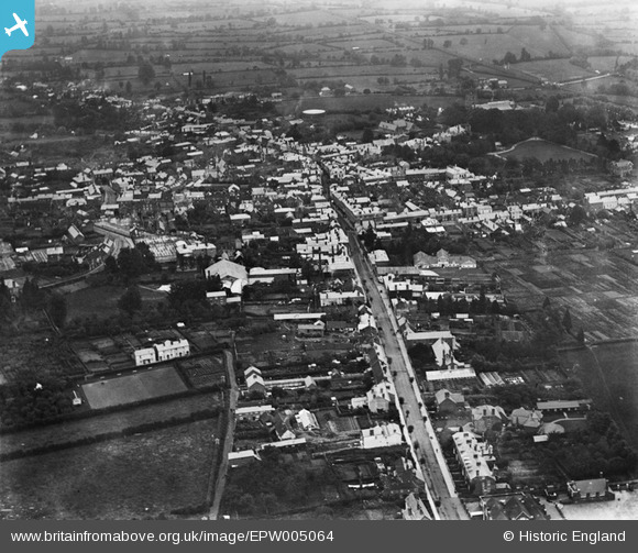
EPW005064 ENGLAND (1920). General view of the town centre, Leominster, 1920
© Hawlfraint cyfranwyr OpenStreetMap a thrwyddedwyd gan yr OpenStreetMap Foundation. 2026. Trwyddedir y gartograffeg fel CC BY-SA.
Delweddau cyfagos (4)
EPW005064

 0°
0m
0°
0m
EPW006998
 9°
216m
9°
216m
EPW005065
 41°
229m
41°
229m
EPW005063
 313°
254m
313°
254m
Manylion
| Pennawd | [EPW005064] General view of the town centre, Leominster, 1920 |
| Cyfeirnod | EPW005064 |
| Dyddiad | September-1920 |
| Dolen | |
| Enw lle | LEOMINSTER |
| Plwyf | LEOMINSTER |
| Ardal | |
| Gwlad | ENGLAND |
| Dwyreiniad / Gogleddiad | 349585, 258825 |
| Hydred / Lledred | -2.7381522642712, 52.224920226092 |
| Cyfeirnod Grid Cenedlaethol | SO496588 |
Pinnau
 the leominster (formerly the britannia) brewery, south street the leominster (formerly the britannia) brewery, south street |

peter stuart legat |
Sunday 7th of June 2020 07:13:57 PM |
| Priory Church |
John W |
Friday 29th of July 2016 06:22:26 PM |
| GWR Branch line to Titley, New Radnor and Presteign. |
John W |
Friday 29th of July 2016 06:21:06 PM |
| Shrewsbury - Hereford railway line |
John W |
Friday 29th of July 2016 06:19:39 PM |
| South Street |

Class31 |
Tuesday 8th of January 2013 08:34:59 PM |