
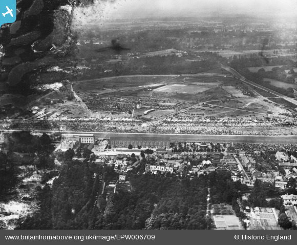
EPW006709 ENGLAND (1921). Ascot, Royal Ascot, from the south, 1921. This image has been produced from a damaged print.
© Hawlfraint cyfranwyr OpenStreetMap a thrwyddedwyd gan yr OpenStreetMap Foundation. 2026. Trwyddedir y gartograffeg fel CC BY-SA.
Delweddau cyfagos (18)
EPW006709

EPW026286

EAW021006

EAW042135

EPW006705

EAW042136

EPW008711

EPW026289

EPW006703

EPW008708

EPW008707

EPW008704

EPW008717

EPW026290

EPW008709

EPW026287

EPW008706

EPW006707

Manylion
| Pennawd | [EPW006709] Ascot, Royal Ascot, from the south, 1921. This image has been produced from a damaged print. |
| Cyfeirnod | EPW006709 |
| Dyddiad | June-1921 |
| Dolen | |
| Enw lle | ASCOT |
| Plwyf | SUNNINGHILL AND ASCOT |
| Ardal | |
| Gwlad | ENGLAND |
| Dwyreiniad / Gogleddiad | 492222, 168918 |
| Hydred / Lledred | -0.67381619465811, 51.411280822989 |
| Cyfeirnod Grid Cenedlaethol | SU922689 |
Pinnau
Byddwch y cyntaf i ychwanegu sylw at y ddelwedd hon!