
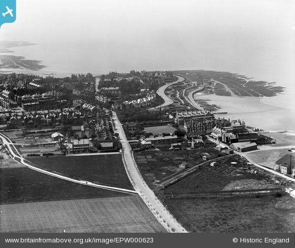
EPW000623 ENGLAND (1920). Westgate Road, Westgate-on-Sea, from the east, 1920
© Hawlfraint cyfranwyr OpenStreetMap a thrwyddedwyd gan yr OpenStreetMap Foundation. 2026. Trwyddedir y gartograffeg fel CC BY-SA.
Delweddau cyfagos (7)
EPW000623

EPW054077

EPW009157

EPW009158

EPW009156

EPW009160

EPW009159

Manylion
| Pennawd | [EPW000623] Westgate Road, Westgate-on-Sea, from the east, 1920 |
| Cyfeirnod | EPW000623 |
| Dyddiad | April-1920 |
| Dolen | |
| Enw lle | WESTGATE-ON-SEA |
| Plwyf | |
| Ardal | |
| Gwlad | ENGLAND |
| Dwyreiniad / Gogleddiad | 632932, 170209 |
| Hydred / Lledred | 1.3478980582105, 51.382552879504 |
| Cyfeirnod Grid Cenedlaethol | TR329702 |
Pinnau
Byddwch y cyntaf i ychwanegu sylw at y ddelwedd hon!