
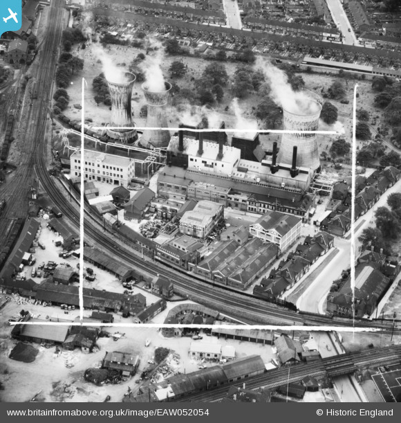
EAW052054 ENGLAND (1953). The Osmond and Sons Ltd Moss Road Works alongside the Moss Road Power Station, Grimsby, 1953. This image was marked by Aerofilms Ltd for photo editing.
© Hawlfraint cyfranwyr OpenStreetMap a thrwyddedwyd gan yr OpenStreetMap Foundation. 2026. Trwyddedir y gartograffeg fel CC BY-SA.
Delweddau cyfagos (14)
EAW052054

EAW052052

EAW052049

EAW052051

EPW042804

EAW052053

EAW052050

EPW053392

EPW042069

EPW042068

EPW042066

EPW042071

EPW042067

EPW042070

Manylion
| Pennawd | [EAW052054] The Osmond and Sons Ltd Moss Road Works alongside the Moss Road Power Station, Grimsby, 1953. This image was marked by Aerofilms Ltd for photo editing. |
| Cyfeirnod | EAW052054 |
| Dyddiad | 7-September-1953 |
| Dolen | |
| Enw lle | GRIMSBY |
| Plwyf | |
| Ardal | |
| Gwlad | ENGLAND |
| Dwyreiniad / Gogleddiad | 527169, 409102 |
| Hydred / Lledred | -0.079723802039994, 53.562859328606 |
| Cyfeirnod Grid Cenedlaethol | TA272091 |
Pinnau

Class31 |
Tuesday 10th of May 2016 11:00:26 PM |
