
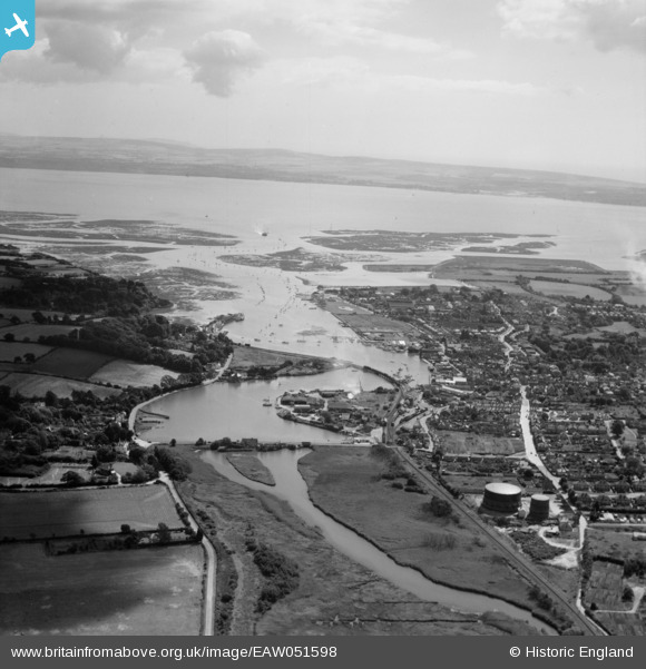
EAW051598 ENGLAND (1953). The Lymington River and the town looking towards the Isle of Wight, Lymington, from the north-west, 1953
© Hawlfraint cyfranwyr OpenStreetMap a thrwyddedwyd gan yr OpenStreetMap Foundation. 2026. Trwyddedir y gartograffeg fel CC BY-SA.
Delweddau cyfagos (3)
EAW051598

EAW043398

EAW051597

Manylion
| Pennawd | [EAW051598] The Lymington River and the town looking towards the Isle of Wight, Lymington, from the north-west, 1953 |
| Cyfeirnod | EAW051598 |
| Dyddiad | 26-August-1953 |
| Dolen | |
| Enw lle | LYMINGTON |
| Plwyf | LYMINGTON AND PENNINGTON |
| Ardal | |
| Gwlad | ENGLAND |
| Dwyreiniad / Gogleddiad | 432668, 96097 |
| Hydred / Lledred | -1.5367528696419, 50.762974376553 |
| Cyfeirnod Grid Cenedlaethol | SZ327961 |
Pinnau
Byddwch y cyntaf i ychwanegu sylw at y ddelwedd hon!