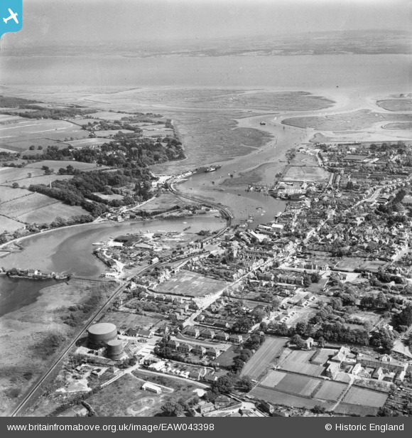
EAW043398 ENGLAND (1952). Lymington River and the Solent, Lymington, from the north-west, 1952
    © Hawlfraint cyfranwyr OpenStreetMap a thrwyddedwyd gan yr OpenStreetMap Foundation. 2025. Trwyddedir y gartograffeg fel CC BY-SA.
  
Manylion
| Pennawd | [EAW043398] Lymington River and the Solent, Lymington, from the north-west, 1952 | 
| Cyfeirnod | EAW043398 | 
| Dyddiad | 23-May-1952 | 
| Dolen | |
| Enw lle | LYMINGTON | 
| Plwyf | LYMINGTON AND PENNINGTON | 
| Ardal | |
| Gwlad | ENGLAND | 
| Dwyreiniad / Gogleddiad | 432549, 95924 | 
| Hydred / Lledred | -1.5384555912186, 50.761425216568 | 
| Cyfeirnod Grid Cenedlaethol | SZ325959 | 
 
             
  ![[EAW043398] Lymington River and the Solent, Lymington, from the north-west, 1952](http://britainfromabove.org.uk/sites/all/libraries/aerofilms-images/public/100x100/EAW/043/EAW043398.jpg) 
  
                                          ![[EAW051598] The Lymington River and the town looking towards the Isle of Wight, Lymington, from the north-west, 1953](http://britainfromabove.org.uk/sites/all/libraries/aerofilms-images/public/100x100/EAW/051/EAW051598.jpg) 
 ![[EAW018160] Lymington River and the town, Lymington, from the north-west, 1948. This image has been produced from a print.](http://britainfromabove.org.uk/sites/all/libraries/aerofilms-images/public/100x100/EAW/018/EAW018160.jpg) 
  Bridge House (former Freemasons Arms PH)
 Bridge House (former Freemasons Arms PH)