
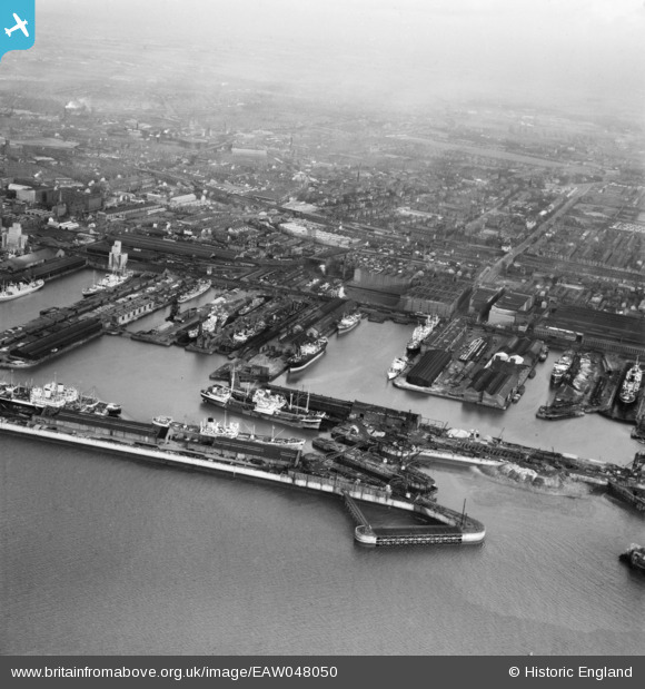
EAW048050 ENGLAND (1952). Langton Dock and Brocklebank Dock, Bootle, from the south-west, 1952
© Hawlfraint cyfranwyr OpenStreetMap a thrwyddedwyd gan yr OpenStreetMap Foundation. 2026. Trwyddedir y gartograffeg fel CC BY-SA.
Delweddau cyfagos (5)
EAW048050

EAW048048

EAW001707

EPW018900

EPW018897

Manylion
| Pennawd | [EAW048050] Langton Dock and Brocklebank Dock, Bootle, from the south-west, 1952 |
| Cyfeirnod | EAW048050 |
| Dyddiad | 12-December-1952 |
| Dolen | |
| Enw lle | BOOTLE |
| Plwyf | |
| Ardal | |
| Gwlad | ENGLAND |
| Dwyreiniad / Gogleddiad | 332987, 394282 |
| Hydred / Lledred | -3.0089660577264, 53.440789226946 |
| Cyfeirnod Grid Cenedlaethol | SJ330943 |
Pinnau

redmist |
Friday 12th of February 2021 08:00:33 PM |