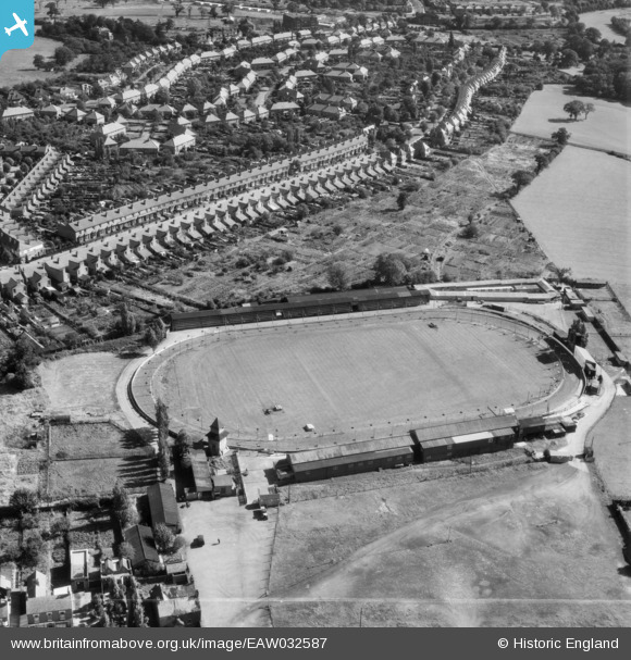
EAW032587 ENGLAND (1950). Kings Heath Greyhound Track and May Lane, Brandwood End, 1950. This image was marked by Aerofilms Ltd for photo editing.
    © Hawlfraint cyfranwyr OpenStreetMap a thrwyddedwyd gan yr OpenStreetMap Foundation. 2025. Trwyddedir y gartograffeg fel CC BY-SA.
  
Delweddau cyfagos (13)
Manylion
| Pennawd | [EAW032587] Kings Heath Greyhound Track and May Lane, Brandwood End, 1950. This image was marked by Aerofilms Ltd for photo editing. | 
| Cyfeirnod | EAW032587 | 
| Dyddiad | 18-October-1950 | 
| Dolen | |
| Enw lle | BRANDWOOD END | 
| Plwyf | |
| Ardal | |
| Gwlad | ENGLAND | 
| Dwyreiniad / Gogleddiad | 407662, 280263 | 
| Hydred / Lledred | -1.8873231570217, 52.419928949074 | 
| Cyfeirnod Grid Cenedlaethol | SP077803 | 
Pinnau
|  School Clinic |   Neil | Sunday 31st of October 2021 01:13:38 AM | 
|  339 Haunch Lane |   Neil | Sunday 31st of October 2021 01:12:30 AM | 
|  The Haunch a.k.a. Haunch House |   Neil | Sunday 31st of October 2021 01:11:30 AM | 
|  The Tudor Cinema |   Neil | Sunday 31st of October 2021 01:10:33 AM | 
|  The Valley Public House |   Neil | Sunday 31st of October 2021 01:10:00 AM | 
Cyfraniadau Grŵp
| 1950's brandwood |   haggie64 | Wednesday 2nd of July 2014 02:19:43 PM | 
 
             
  ![[EAW032587] Kings Heath Greyhound Track and May Lane, Brandwood End, 1950. This image was marked by Aerofilms Ltd for photo editing.](http://britainfromabove.org.uk/sites/all/libraries/aerofilms-images/public/100x100/EAW/032/EAW032587.jpg) 
  
                                          ![[EAW032586] Kings Heath Greyhound Track, Brandwood End, 1950](http://britainfromabove.org.uk/sites/all/libraries/aerofilms-images/public/100x100/EAW/032/EAW032586.jpg) 
 ![[EAW032592] Kings Heath Greyhound Track and May Lane, Brandwood End, 1950](http://britainfromabove.org.uk/sites/all/libraries/aerofilms-images/public/100x100/EAW/032/EAW032592.jpg) 
 ![[EAW032588] Kings Heath Greyhound Track, Brandwood End, 1950](http://britainfromabove.org.uk/sites/all/libraries/aerofilms-images/public/100x100/EAW/032/EAW032588.jpg) 
 ![[EAW032593] Kings Heath Greyhound Track, Brandwood End, 1950. This image was marked by Aerofilms Ltd for photo editing.](http://britainfromabove.org.uk/sites/all/libraries/aerofilms-images/public/100x100/EAW/032/EAW032593.jpg) 
 ![[EPW027016] The Greyhound Stadium, King's Heath, 1929](http://britainfromabove.org.uk/sites/all/libraries/aerofilms-images/public/100x100/EPW/027/EPW027016.jpg) 
 ![[EAW032591] Kings Heath Greyhound Track, Brandwood End, 1950](http://britainfromabove.org.uk/sites/all/libraries/aerofilms-images/public/100x100/EAW/032/EAW032591.jpg) 
 ![[EAW032589] Kings Heath Greyhound Track and Alcester Road South, Brandwood End, 1950](http://britainfromabove.org.uk/sites/all/libraries/aerofilms-images/public/100x100/EAW/032/EAW032589.jpg) 
 ![[EAW032597] Kings Heath Greyhound Track and environs, Brandwood End, 1950](http://britainfromabove.org.uk/sites/all/libraries/aerofilms-images/public/100x100/EAW/032/EAW032597.jpg) 
 ![[EAW032595] Kings Heath Greyhound Track and environs, Brandwood End, 1950](http://britainfromabove.org.uk/sites/all/libraries/aerofilms-images/public/100x100/EAW/032/EAW032595.jpg) 
 ![[EAW032590] Kings Heath Greyhound Track and environs, Brandwood End, 1950. This image was marked by Aerofilms Ltd for photo editing.](http://britainfromabove.org.uk/sites/all/libraries/aerofilms-images/public/100x100/EAW/032/EAW032590.jpg) 
 ![[EAW032594] Kings Heath Greyhound Track and environs, Brandwood End, 1950](http://britainfromabove.org.uk/sites/all/libraries/aerofilms-images/public/100x100/EAW/032/EAW032594.jpg) 
 ![[EAW032596] Kings Heath Greyhound Track and the Brandwood End Cemetery, Brandwood End, 1950](http://britainfromabove.org.uk/sites/all/libraries/aerofilms-images/public/100x100/EAW/032/EAW032596.jpg)