
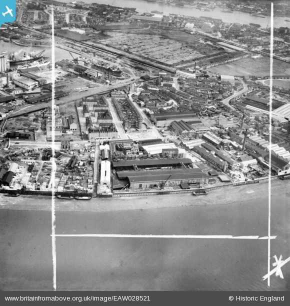
EAW028521 ENGLAND (1950). The Napier Yard and environs, Millwall, 1950. This image was marked by Aerofilms Ltd for photo editing.
© Hawlfraint cyfranwyr OpenStreetMap a thrwyddedwyd gan yr OpenStreetMap Foundation. 2026. Trwyddedir y gartograffeg fel CC BY-SA.
Delweddau cyfagos (11)
EAW028521

EAW028529

EAW028526

EAW028528

EAW028525

EAW028523

EAW028524

EAW028522

EAW028527

EAW021719

EPW025712

Manylion
| Pennawd | [EAW028521] The Napier Yard and environs, Millwall, 1950. This image was marked by Aerofilms Ltd for photo editing. |
| Cyfeirnod | EAW028521 |
| Dyddiad | 5-April-1950 |
| Dolen | |
| Enw lle | MILLWALL |
| Plwyf | |
| Ardal | |
| Gwlad | ENGLAND |
| Dwyreiniad / Gogleddiad | 537511, 178512 |
| Hydred / Lledred | -0.019164566224265, 51.488329347548 |
| Cyfeirnod Grid Cenedlaethol | TQ375785 |
Pinnau

moses72 |
Friday 5th of September 2014 04:12:14 PM | |
|
moses72 |
Friday 5th of September 2014 04:10:12 PM | |
|
moses72 |
Friday 5th of September 2014 04:08:47 PM | |
|
moses72 |
Friday 5th of September 2014 04:08:16 PM |