
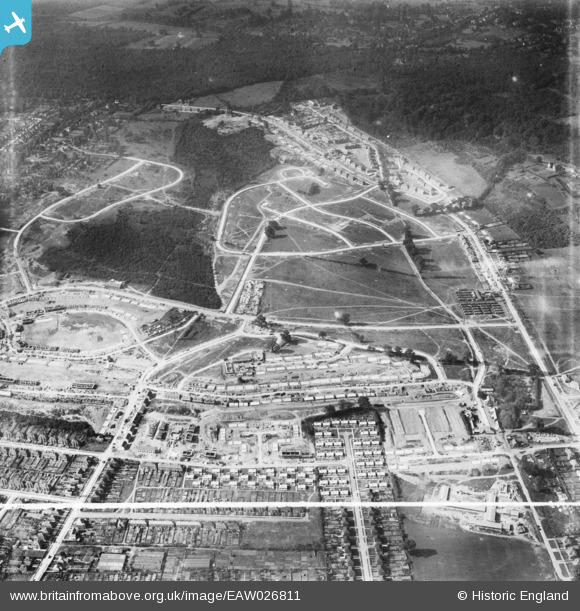
EAW026811 ENGLAND (1949). Housing estate under construction at St Paul's Cray, Bromley, 1949. This image was marked by Aerofilms Ltd for photo editing.
© Hawlfraint cyfranwyr OpenStreetMap a thrwyddedwyd gan yr OpenStreetMap Foundation. 2026. Trwyddedir y gartograffeg fel CC BY-SA.
Delweddau cyfagos (3)
EAW026811

EAW021758

EAW020734

Manylion
| Pennawd | [EAW026811] Housing estate under construction at St Paul's Cray, Bromley, 1949. This image was marked by Aerofilms Ltd for photo editing. |
| Cyfeirnod | EAW026811 |
| Dyddiad | 3-October-1949 |
| Dolen | |
| Enw lle | BROMLEY |
| Plwyf | |
| Ardal | |
| Gwlad | ENGLAND |
| Dwyreiniad / Gogleddiad | 546328, 169431 |
| Hydred / Lledred | 0.10399870939103, 51.404509745247 |
| Cyfeirnod Grid Cenedlaethol | TQ463694 |
Pinnau

Post-war prefabs |
Saturday 2nd of November 2019 11:20:31 AM |