
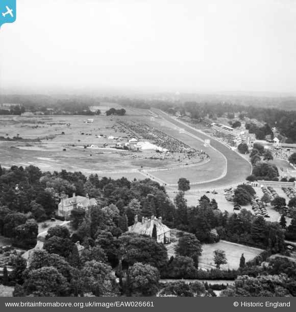
EAW026661 ENGLAND (1949). The Racecourse, Ascot, from the north-west, 1949
© Hawlfraint cyfranwyr OpenStreetMap a thrwyddedwyd gan yr OpenStreetMap Foundation. 2026. Trwyddedir y gartograffeg fel CC BY-SA.
Delweddau cyfagos (7)
EAW026661

EPW006702

EAW022114

EPW006700

EPW008710
, Ascot, 1923")
EAW022115

EPW006708

Manylion
| Pennawd | [EAW026661] The Racecourse, Ascot, from the north-west, 1949 |
| Cyfeirnod | EAW026661 |
| Dyddiad | 22-September-1949 |
| Dolen | |
| Enw lle | ASCOT |
| Plwyf | SUNNINGHILL AND ASCOT |
| Ardal | |
| Gwlad | ENGLAND |
| Dwyreiniad / Gogleddiad | 491624, 169265 |
| Hydred / Lledred | -0.68232349429996, 51.414497411817 |
| Cyfeirnod Grid Cenedlaethol | SU916693 |
Pinnau
Byddwch y cyntaf i ychwanegu sylw at y ddelwedd hon!