
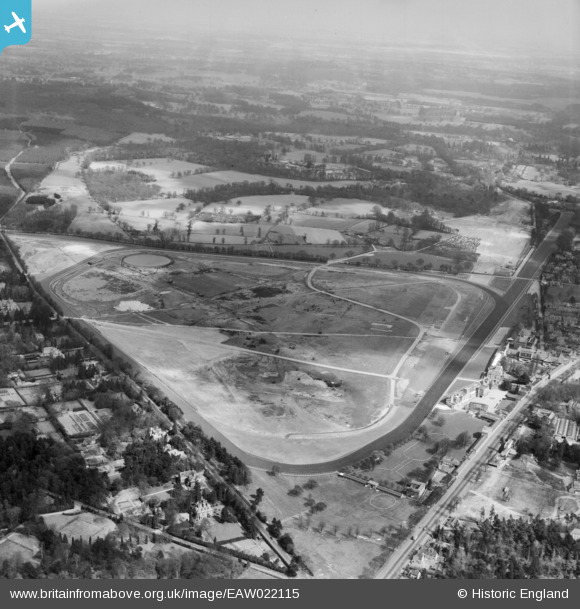
EAW022115 ENGLAND (1949). Ascot Racecourse, Ascot, from the west, 1949
© Hawlfraint cyfranwyr OpenStreetMap a thrwyddedwyd gan yr OpenStreetMap Foundation. 2026. Trwyddedir y gartograffeg fel CC BY-SA.
Delweddau cyfagos (24)
EAW022115

EPW006708

EPW006700

EAW022114

EAW042137

EAW022117

EPW013401

EPW006702

EPW026284

EPW006707

EPW013441

EPW006706

EPW008715

EPW008705

EPW008709

EPW036160

EPW008716

EPW008704

EPW026290

EPW026285

EPW006704

EAW026661

EPW008707

EAW022116

Manylion
| Pennawd | [EAW022115] Ascot Racecourse, Ascot, from the west, 1949 |
| Cyfeirnod | EAW022115 |
| Dyddiad | 14-April-1949 |
| Dolen | |
| Enw lle | ASCOT |
| Plwyf | SUNNINGHILL AND ASCOT |
| Ardal | |
| Gwlad | ENGLAND |
| Dwyreiniad / Gogleddiad | 491831, 169125 |
| Hydred / Lledred | -0.67938367535127, 51.413205278684 |
| Cyfeirnod Grid Cenedlaethol | SU918691 |
Pinnau
Byddwch y cyntaf i ychwanegu sylw at y ddelwedd hon!