
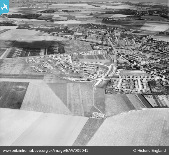
EAW009041 ENGLAND (1947). The residential area at Newington (surrounding Melbourne Avenue) under construction and the surrounding area, Ramsgate, 1947
© Hawlfraint cyfranwyr OpenStreetMap a thrwyddedwyd gan yr OpenStreetMap Foundation. 2026. Trwyddedir y gartograffeg fel CC BY-SA.
Delweddau cyfagos (5)
EAW009041
 under construction and the surrounding area, Ramsgate, 1947")
EAW009035
 under construction and the surrounding area, Ramsgate, 1947")
EAW009036
 under construction, Ramsgate, 1947")
EAW009040
 under construction, Ramsgate, 1947")
EAW009032
 under construction, Ramsgate, 1947")
Manylion
| Pennawd | [EAW009041] The residential area at Newington (surrounding Melbourne Avenue) under construction and the surrounding area, Ramsgate, 1947 |
| Cyfeirnod | EAW009041 |
| Dyddiad | 12-August-1947 |
| Dolen | |
| Enw lle | RAMSGATE |
| Plwyf | RAMSGATE |
| Ardal | |
| Gwlad | ENGLAND |
| Dwyreiniad / Gogleddiad | 636517, 166218 |
| Hydred / Lledred | 1.3966737708763, 51.345243822609 |
| Cyfeirnod Grid Cenedlaethol | TR365662 |
Pinnau
Byddwch y cyntaf i ychwanegu sylw at y ddelwedd hon!