
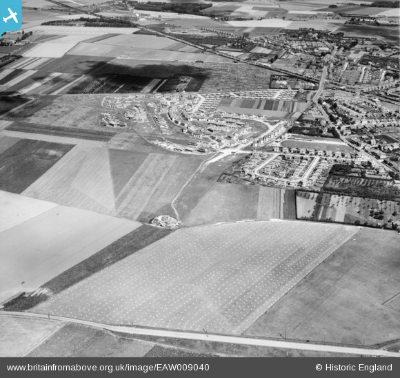
EAW009040 ENGLAND (1947). The residential area at Newington (surrounding Melbourne Avenue) under construction, Ramsgate, 1947
© Hawlfraint cyfranwyr OpenStreetMap a thrwyddedwyd gan yr OpenStreetMap Foundation. 2026. Trwyddedir y gartograffeg fel CC BY-SA.
Delweddau cyfagos (3)
EAW009040
 under construction, Ramsgate, 1947")
EAW009041
 under construction and the surrounding area, Ramsgate, 1947")
EPW043753

Manylion
| Pennawd | [EAW009040] The residential area at Newington (surrounding Melbourne Avenue) under construction, Ramsgate, 1947 |
| Cyfeirnod | EAW009040 |
| Dyddiad | 12-August-1947 |
| Dolen | |
| Enw lle | RAMSGATE |
| Plwyf | RAMSGATE |
| Ardal | |
| Gwlad | ENGLAND |
| Dwyreiniad / Gogleddiad | 636470, 166008 |
| Hydred / Lledred | 1.3958605799816, 51.343378219248 |
| Cyfeirnod Grid Cenedlaethol | TR365660 |
Pinnau
Byddwch y cyntaf i ychwanegu sylw at y ddelwedd hon!