
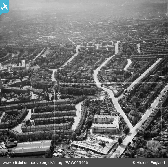
EAW005466 ENGLAND (1947). Carleton Road and environs, Tufnell Park, 1947. This image was marked by Aerofilms Ltd for photo editing.
© Hawlfraint cyfranwyr OpenStreetMap a thrwyddedwyd gan yr OpenStreetMap Foundation. 2026. Trwyddedir y gartograffeg fel CC BY-SA.
Delweddau cyfagos (14)
EAW005466

EAW005455

EAW005459

EAW005460

EAW005453

EPW053670

EAW005449

EAW005458

EAW015855

EAW005457

EAW005454

EAW005467

EAW005461

EAW005450

Manylion
| Pennawd | [EAW005466] Carleton Road and environs, Tufnell Park, 1947. This image was marked by Aerofilms Ltd for photo editing. |
| Cyfeirnod | EAW005466 |
| Dyddiad | May-1947 |
| Dolen | |
| Enw lle | TUFNELL PARK |
| Plwyf | |
| Ardal | |
| Gwlad | ENGLAND |
| Dwyreiniad / Gogleddiad | 529893, 185731 |
| Hydred / Lledred | -0.12617457099032, 51.555012888826 |
| Cyfeirnod Grid Cenedlaethol | TQ299857 |
