
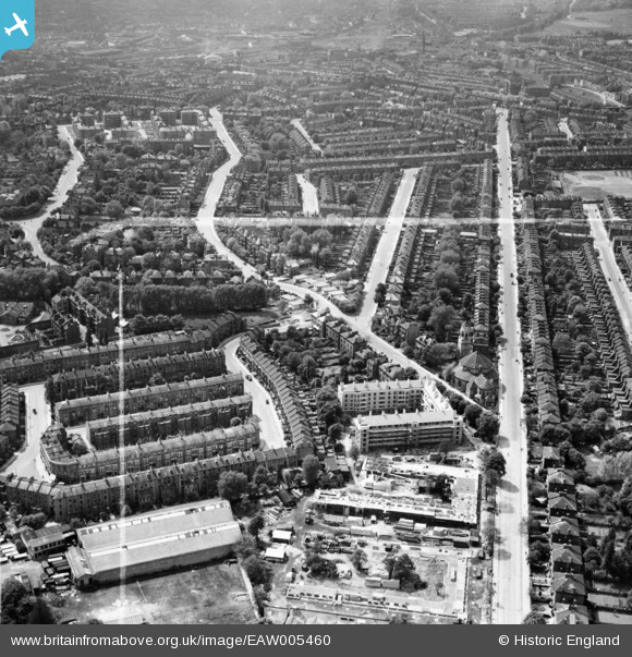
EAW005460 ENGLAND (1947). Tufnell Park Road and construction of Hollins House and McCall House, Tufnell Park, 1947. This image was marked by Aerofilms Ltd for photo editing.
© Hawlfraint cyfranwyr OpenStreetMap a thrwyddedwyd gan yr OpenStreetMap Foundation. 2026. Trwyddedir y gartograffeg fel CC BY-SA.
Delweddau cyfagos (9)
EAW005460

EAW005466

EAW005455

EAW005459

EAW005461

EAW005465

EAW005458

EAW005467

EAW005456

Manylion
| Pennawd | [EAW005460] Tufnell Park Road and construction of Hollins House and McCall House, Tufnell Park, 1947. This image was marked by Aerofilms Ltd for photo editing. |
| Cyfeirnod | EAW005460 |
| Dyddiad | May-1947 |
| Dolen | |
| Enw lle | TUFNELL PARK |
| Plwyf | |
| Ardal | |
| Gwlad | ENGLAND |
| Dwyreiniad / Gogleddiad | 529967, 185865 |
| Hydred / Lledred | -0.12505813483098, 51.556200181005 |
| Cyfeirnod Grid Cenedlaethol | TQ300859 |
