
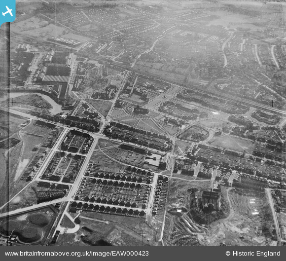
EAW000423 ENGLAND (1946). Bolton Road, Port Sunlight and environs, Bromborough, 1946
© Hawlfraint cyfranwyr OpenStreetMap a thrwyddedwyd gan yr OpenStreetMap Foundation. 2026. Trwyddedir y gartograffeg fel CC BY-SA.
Delweddau cyfagos (9)
EAW000423

EAW000419

EAW000424

EPW044481

EAW000420

EPW044479

EAW000422

EPW044475

EAW000417

Manylion
| Pennawd | [EAW000423] Bolton Road, Port Sunlight and environs, Bromborough, 1946 |
| Cyfeirnod | EAW000423 |
| Dyddiad | 18-April-1946 |
| Dolen | |
| Enw lle | BROMBOROUGH |
| Plwyf | |
| Ardal | |
| Gwlad | ENGLAND |
| Dwyreiniad / Gogleddiad | 333891, 384600 |
| Hydred / Lledred | -2.9933287082047, 53.353879046923 |
| Cyfeirnod Grid Cenedlaethol | SJ339846 |
Pinnau

redmist |
Sunday 13th of October 2019 09:28:30 PM | |
|
redmist |
Sunday 13th of October 2019 11:31:38 AM | |
|
Debs. |
Tuesday 29th of April 2014 07:51:19 PM |
Cyfraniadau Grŵp
This photo is interesting as if you check 'newferryonline.org.uk' MEMORIES AND PHOTOS-1970s and scroll down to MAYFIELDS FOOTBALL PITCHES you will see a photo claiming to show the hill containing the Pluto tanks. This hill is plainly in view today. This hill is definitely not where these tanks are shown on the 1946 photo. It is to the right, on this photo, but must have been built at a later date. |
kenny |
Monday 4th of May 2015 09:14:13 PM |