
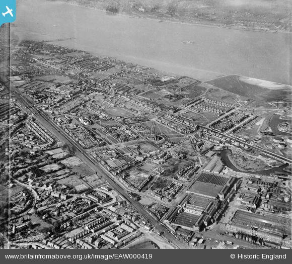
EAW000419 ENGLAND (1946). Port Sunlight and the River Mersey, Bromborough, 1946
© Hawlfraint cyfranwyr OpenStreetMap a thrwyddedwyd gan yr OpenStreetMap Foundation. 2026. Trwyddedir y gartograffeg fel CC BY-SA.
Delweddau cyfagos (11)
EAW000419

EAW000424

EAW000423

EPW044479

EAW000420

EAW000422

EAW000421

EPW044474

EPW044481

EPW044473

EPW044475

Manylion
| Pennawd | [EAW000419] Port Sunlight and the River Mersey, Bromborough, 1946 |
| Cyfeirnod | EAW000419 |
| Dyddiad | 18-April-1946 |
| Dolen | |
| Enw lle | BROMBOROUGH |
| Plwyf | |
| Ardal | |
| Gwlad | ENGLAND |
| Dwyreiniad / Gogleddiad | 333844, 384704 |
| Hydred / Lledred | -2.9940565471846, 53.354807953986 |
| Cyfeirnod Grid Cenedlaethol | SJ338847 |
Pinnau

Matt Aldred edob.mattaldred.com |
Friday 26th of February 2021 06:04:04 PM | |

redmist |
Sunday 13th of October 2019 09:10:21 PM | |
|
redmist |
Sunday 13th of October 2019 09:04:01 PM | |
|
redmist |
Sunday 13th of October 2019 08:59:29 PM | |
|
redmist |
Sunday 13th of October 2019 08:57:30 PM | |
|
redmist |
Sunday 13th of October 2019 08:52:33 PM |