Skip to main content
Prydain oddi Fry
Cymraeg
|
English
Mewngofnod
|
Cofrestru
Toggle navigation
Hafan
Gwaddol
Ynghylch
Map
Orielau
Grwpiau
Cymorth
Chwilio
Pob Gwlad (96344)
Lloegr (82521)
Yr Alban (6398)
Cymru (4321)
Gweddill y Byd (3104)
Gwlad Belg (7)
Ffrainc (27)
yr Almaen (2)
Guernsey (116)
Iran (8)
Irac (6)
Iwerddon (1466)
Ynys Manaw (75)
Jersey (122)
yr Iseldiroedd (20)
Northern Ireland (1163)
Sbaen (9)
y Swisdir (26)
Featured Gallery - Images with damaged negatives
All Galleries
Pagination
First page
first
Previous page
previous
…
Tudalen
11
Tudalen
12
Tudalen
13
Tudalen
14
Current page
15
Tudalen
16
Tudalen
17
Tudalen
18
Tudalen
19
…
Next page
next
Last page
last
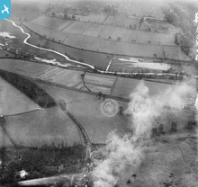
The River Colne near the site of Merchant Ta...
Tolpits Lane, Moor Farm and environs, Moor Park, ...
The junction of the Rickmansworth and Croxley Mil...
The London Electric Railway Co Carriage Cl...
The town, Somersham, from the west, 1930. This ...
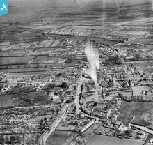
The High Street and the Market Place, Market Deep...
Oil terminal, North Killingholme Haven, 1930...
The Royal National Hospital for Diseases of...
Pagination
First page
first
Previous page
previous
…
Tudalen
11
Tudalen
12
Tudalen
13
Tudalen
14
Current page
15
Tudalen
16
Tudalen
17
Tudalen
18
Tudalen
19
…
Next page
next
Last page
last