
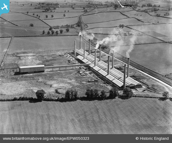
EPW050323 ENGLAND (1936). The Ridgmont Brick Works, Brogborough, 1936
© Copyright OpenStreetMap contributors and licensed by the OpenStreetMap Foundation. 2026. Cartography is licensed as CC BY-SA.
Nearby Images (12)
EPW050323

EPW050318

EPW050317

EPW050319

EPW050324

EPW050314

EPW050320

EPW050322

EPW050316

EPW050325

EPW050321

EPW050311

Details
| Title | [EPW050323] The Ridgmont Brick Works, Brogborough, 1936 |
| Reference | EPW050323 |
| Date | May-1936 |
| Link | |
| Place name | BROGBOROUGH |
| Parish | BROGBOROUGH |
| District | |
| Country | ENGLAND |
| Easting / Northing | 496671, 237764 |
| Longitude / Latitude | -0.59074526436263, 52.029429622272 |
| National Grid Reference | SP967378 |
Pins

melgibbs |
Thursday 6th of February 2014 03:57:40 PM |