
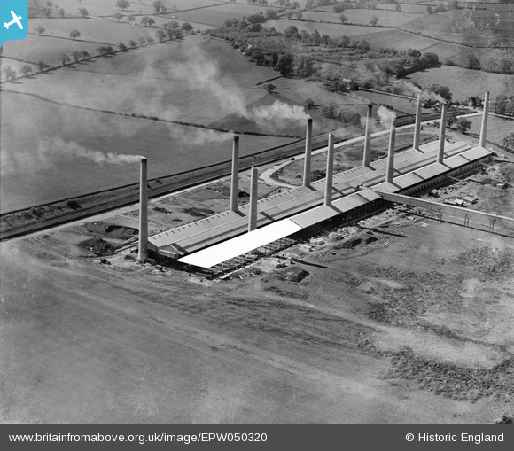
EPW050320 ENGLAND (1936). The Ridgmont Brick Works, Brogborough, 1936
© Copyright OpenStreetMap contributors and licensed by the OpenStreetMap Foundation. 2026. Cartography is licensed as CC BY-SA.
Nearby Images (11)
EPW050320

EPW050322

EPW050317

EPW050325

EPW050323

EPW050318

EPW050324

EAW028103

EPW050319

EPW050314

EAW028102

Details
| Title | [EPW050320] The Ridgmont Brick Works, Brogborough, 1936 |
| Reference | EPW050320 |
| Date | May-1936 |
| Link | |
| Place name | BROGBOROUGH |
| Parish | BROGBOROUGH |
| District | |
| Country | ENGLAND |
| Easting / Northing | 496790, 237842 |
| Longitude / Latitude | -0.58898899715406, 52.030110003626 |
| National Grid Reference | SP968378 |
Pins

melgibbs |
Thursday 6th of February 2014 04:26:03 PM |