
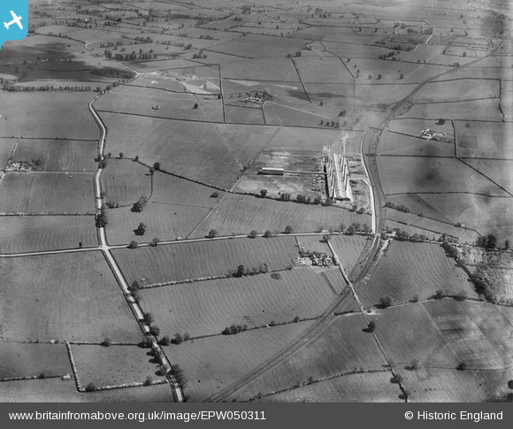
EPW050311 ENGLAND (1936). The Ridgmont Brick Works and surrounding countryside, Brogborough, 1936
© Copyright OpenStreetMap contributors and licensed by the OpenStreetMap Foundation. 2026. Cartography is licensed as CC BY-SA.
Nearby Images (5)
EPW050311

EPW050315

EPW050318

EPW050314

EPW050323

Details
| Title | [EPW050311] The Ridgmont Brick Works and surrounding countryside, Brogborough, 1936 |
| Reference | EPW050311 |
| Date | May-1936 |
| Link | |
| Place name | BROGBOROUGH |
| Parish | BROGBOROUGH |
| District | |
| Country | ENGLAND |
| Easting / Northing | 496427, 237708 |
| Longitude / Latitude | -0.59431688586777, 52.028968721771 |
| National Grid Reference | SP964377 |
Pins

melgibbs |
Wednesday 5th of February 2014 01:54:51 PM | |
|
melgibbs |
Wednesday 5th of February 2014 01:52:11 PM | |
|
melgibbs |
Wednesday 5th of February 2014 01:47:53 PM |