
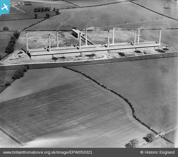
EPW050321 ENGLAND (1936). The Ridgmont Brick Works, Ridgmont, 1936
© Copyright OpenStreetMap contributors and licensed by the OpenStreetMap Foundation. 2026. Cartography is licensed as CC BY-SA.
Nearby Images (8)
EPW050321

EPW050316

EPW050324

EPW050314

EPW050319

EPW050318

EPW050317

EPW050323

Details
| Title | [EPW050321] The Ridgmont Brick Works, Ridgmont, 1936 |
| Reference | EPW050321 |
| Date | May-1936 |
| Link | |
| Place name | RIDGMONT |
| Parish | RIDGMONT |
| District | |
| Country | ENGLAND |
| Easting / Northing | 496810, 237567 |
| Longitude / Latitude | -0.58877536286537, 52.027634546597 |
| National Grid Reference | SP968376 |
Pins

melgibbs |
Thursday 6th of February 2014 03:55:00 PM |