
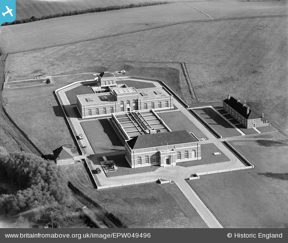
EPW049496 ENGLAND (1935). The Oxford Corporation Water Works, Swinford, 1935
© Copyright OpenStreetMap contributors and licensed by the OpenStreetMap Foundation. 2025. Cartography is licensed as CC BY-SA.
Nearby Images (7)
EPW049496

EPW049492

EPW049495

EPW049498

EPW049494

EPW049497

EPW049493

Details
| Title | [EPW049496] The Oxford Corporation Water Works, Swinford, 1935 |
| Reference | EPW049496 |
| Date | October-1935 |
| Link | |
| Place name | SWINFORD |
| Parish | CUMNOR |
| District | |
| Country | ENGLAND |
| Easting / Northing | 444593, 208525 |
| Longitude / Latitude | -1.3536311165006, 51.773166999881 |
| National Grid Reference | SP446085 |
Pins

Dylan Moore |
Friday 3rd of May 2013 02:06:53 PM | |
Thank you for identifying the location of this image, Dylan. We'll update the catalogue and post the new record here in due course. Yours, Katy Britain from Above Cataloguing Team Leader |
Katy Whitaker |
Tuesday 2nd of July 2013 03:21:58 PM |