
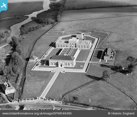
EPW049495 ENGLAND (1935). The Oxford Corporation Water Works, Swinford, 1935
© Copyright OpenStreetMap contributors and licensed by the OpenStreetMap Foundation. 2025. Cartography is licensed as CC BY-SA.
Nearby Images (7)
EPW049495

EPW049498

EPW049492

EPW049496

EPW049494

EPW049497

EPW049493

Details
| Title | [EPW049495] The Oxford Corporation Water Works, Swinford, 1935 |
| Reference | EPW049495 |
| Date | October-1935 |
| Link | |
| Place name | SWINFORD |
| Parish | CUMNOR |
| District | |
| Country | ENGLAND |
| Easting / Northing | 444562, 208515 |
| Longitude / Latitude | -1.3540817096965, 51.773079554188 |
| National Grid Reference | SP446085 |
Pins

Dylan Moore |
Tuesday 28th of May 2013 05:11:46 PM | |
|
Dylan Moore |
Friday 3rd of May 2013 02:11:30 PM |
User Comment Contributions
Thank you! It seems from the Register entry that this and the others in the run were taken for the builders (but we can't be sure). We'll update the catalogue and post the new record here in due course. Yours, Katy Britain from Above Cataloguing Team Leader |
Katy Whitaker |
Tuesday 2nd of July 2013 03:21:23 PM |
Agree completely. Swinford Lock House in bottom left corner. |

Horsegunner |
Saturday 4th of May 2013 11:05:31 AM |