
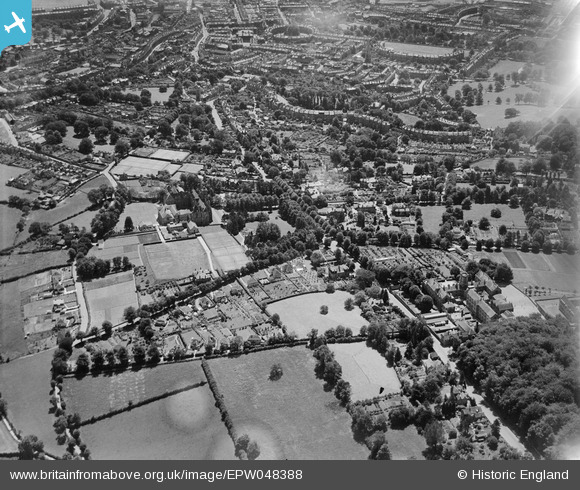
EPW048388 ENGLAND (1935). Kingswood School, the Royal School, Lansdown Road and environs, Lansdown, 1935
© Copyright OpenStreetMap contributors and licensed by the OpenStreetMap Foundation. 2026. Cartography is licensed as CC BY-SA.
Nearby Images (7)
EPW048388

EPR000132

EPW001947

EPW001956

EPW048389

EAW040768

EPR000135

Details
| Title | [EPW048388] Kingswood School, the Royal School, Lansdown Road and environs, Lansdown, 1935 |
| Reference | EPW048388 |
| Date | July-1935 |
| Link | |
| Place name | LANSDOWN |
| Parish | |
| District | |
| Country | ENGLAND |
| Easting / Northing | 374554, 166572 |
| Longitude / Latitude | -2.3658024577896, 51.397115885059 |
| National Grid Reference | ST746666 |
Pins

Class31 |
Saturday 18th of May 2013 08:37:23 PM |
User Comment Contributions
View looking south. |
Class31 |
Sunday 12th of January 2014 10:47:39 AM |