
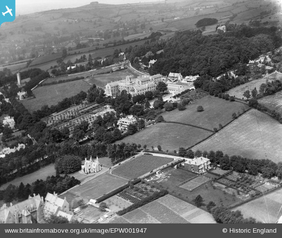
EPW001947 ENGLAND (1920). Kingswood School, Bath, from the south-east, 1920
© Copyright OpenStreetMap contributors and licensed by the OpenStreetMap Foundation. 2026. Cartography is licensed as CC BY-SA.
Nearby Images (4)
EPW001947

EPW048388

EPR000132

EPW001956

Details
| Title | [EPW001947] Kingswood School, Bath, from the south-east, 1920 |
| Reference | EPW001947 |
| Date | July-1920 |
| Link | |
| Place name | LANSDOWN |
| Parish | |
| District | |
| Country | ENGLAND |
| Easting / Northing | 374603, 166666 |
| Longitude / Latitude | -2.3651047962894, 51.39796337474 |
| National Grid Reference | ST746667 |
Pins

Class31 |
Tuesday 10th of July 2012 11:20:29 AM | |
|
Class31 |
Tuesday 10th of July 2012 11:18:06 AM | |
|
Class31 |
Tuesday 10th of July 2012 11:17:17 AM | |
|
Class31 |
Tuesday 10th of July 2012 11:16:26 AM | |
|
Class31 |
Tuesday 10th of July 2012 11:16:03 AM |