
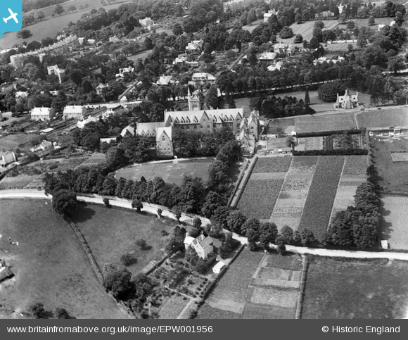
EPW001956 ENGLAND (1920). The Royal School, Lansdown, Bath, 1920
© Copyright OpenStreetMap contributors and licensed by the OpenStreetMap Foundation. 2026. Cartography is licensed as CC BY-SA.
Nearby Images (5)
EPW001956

EPR000132

EPW048388

EPW001947

EPW048389

Details
| Title | [EPW001956] The Royal School, Lansdown, Bath, 1920 |
| Reference | EPW001956 |
| Date | July-1920 |
| Link | |
| Place name | LANSDOWN |
| Parish | |
| District | |
| Country | ENGLAND |
| Easting / Northing | 374724, 166533 |
| Longitude / Latitude | -2.3633558739316, 51.396772780172 |
| National Grid Reference | ST747665 |
Pins

H Campbell |
Friday 10th of January 2014 09:59:53 PM | |
|
Rebecca |
Tuesday 15th of January 2013 01:22:21 PM | |

Class31 |
Tuesday 10th of July 2012 11:14:12 AM | |
|
Class31 |
Tuesday 10th of July 2012 11:13:25 AM | |
|
Class31 |
Tuesday 10th of July 2012 11:12:46 AM |