
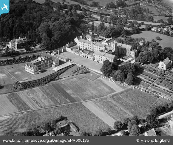
EPR000135 ENGLAND (1934). Kingswood School, Lansdown, 1934
© Copyright OpenStreetMap contributors and licensed by the OpenStreetMap Foundation. 2026. Cartography is licensed as CC BY-SA.
Nearby Images (6)
EPR000135

EAW040768

EAW040769

EAW040766

EAW040767

EPW048388

Details
| Title | [EPR000135] Kingswood School, Lansdown, 1934 |
| Reference | EPR000135 |
| Date | 4-July-1934 |
| Link | |
| Place name | LANSDOWN |
| Parish | |
| District | |
| Country | ENGLAND |
| Easting / Northing | 374313, 166688 |
| Longitude / Latitude | -2.3692753084866, 51.398148148161 |
| National Grid Reference | ST743667 |
Pins
Be the first to add a comment to this image!