
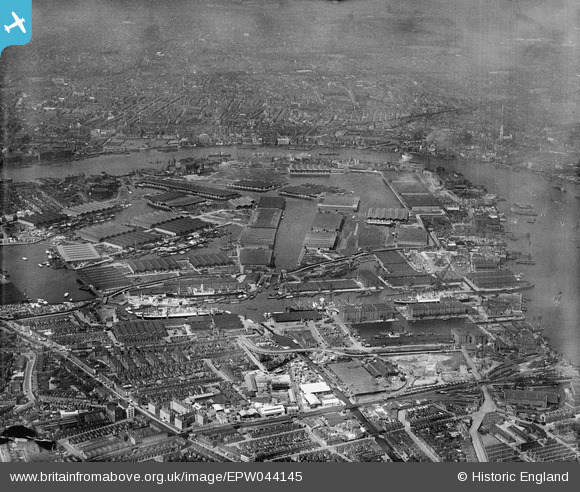
EPW044145 ENGLAND (1934). Surrey Commercial Docks, Rotherhithe, from the south-east, 1934
© Copyright OpenStreetMap contributors and licensed by the OpenStreetMap Foundation. 2026. Cartography is licensed as CC BY-SA.
Nearby Images (20)
EPW044145

EAW118732

EPW044147

EAW029490

EPW044144

EPW018115

EAW025496

EPW044143

EAW025500

EAW025499

EPW036268

EPW036266

EPW035609

EAW025497

EPW035611

EAW025501

EAW025495

EPW035608

EPW035612

EPW036267

Details
| Title | [EPW044145] Surrey Commercial Docks, Rotherhithe, from the south-east, 1934 |
| Reference | EPW044145 |
| Date | May-1934 |
| Link | |
| Place name | ROTHERHITHE |
| Parish | |
| District | |
| Country | ENGLAND |
| Easting / Northing | 536205, 179008 |
| Longitude / Latitude | -0.037774048002099, 51.493103156337 |
| National Grid Reference | TQ362790 |
Pins

Class31 |
Sunday 5th of October 2014 02:41:29 PM |
