
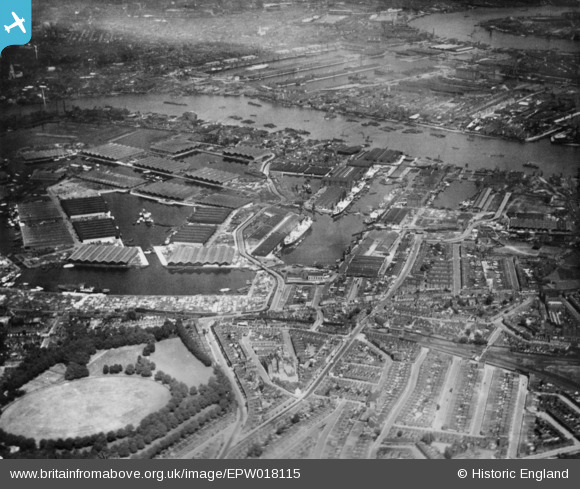
EPW018115 ENGLAND (1927). Surrey Commercial Docks, Rotherhithe, 1927. This image has been produced from a copy-negative.
© Copyright OpenStreetMap contributors and licensed by the OpenStreetMap Foundation. 2026. Cartography is licensed as CC BY-SA.
Nearby Images (7)
EPW018115

EAW029490

EAW118732

EAW025479

EPW044145

EPW044142

EAW043642

Details
| Title | [EPW018115] Surrey Commercial Docks, Rotherhithe, 1927. This image has been produced from a copy-negative. |
| Reference | EPW018115 |
| Date | May-1927 |
| Link | |
| Place name | ROTHERHITHE |
| Parish | |
| District | |
| Country | ENGLAND |
| Easting / Northing | 536019, 179152 |
| Longitude / Latitude | -0.040396445273077, 51.494442106724 |
| National Grid Reference | TQ360792 |
Pins
Be the first to add a comment to this image!