
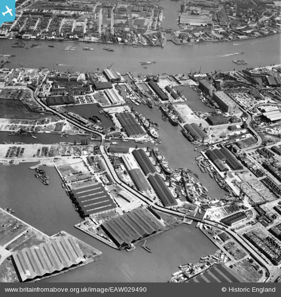
EAW029490 ENGLAND (1950). Surrey Commercial Docks, Rotherhithe, 1950
© Copyright OpenStreetMap contributors and licensed by the OpenStreetMap Foundation. 2026. Cartography is licensed as CC BY-SA.
Nearby Images (6)
EAW029490

EAW025479

EAW118732

EPW018115

EPW044145

EPW044147

Details
| Title | [EAW029490] Surrey Commercial Docks, Rotherhithe, 1950 |
| Reference | EAW029490 |
| Date | 11-May-1950 |
| Link | |
| Place name | ROTHERHITHE |
| Parish | |
| District | |
| Country | ENGLAND |
| Easting / Northing | 536168, 179193 |
| Longitude / Latitude | -0.03823535624522, 51.494774709781 |
| National Grid Reference | TQ362792 |
Pins

Robin |
Thursday 31st of December 2020 11:12:15 AM | |
|
Robin |
Thursday 31st of December 2020 10:36:21 AM | |
|
Robin |
Thursday 31st of December 2020 10:36:02 AM | |
|
Robin |
Thursday 31st of December 2020 10:33:55 AM | |
|
chainbull |
Sunday 27th of July 2014 12:16:07 PM | |
|
chainbull |
Sunday 27th of July 2014 12:15:29 PM | |
|
chainbull |
Sunday 27th of July 2014 12:14:51 PM |