
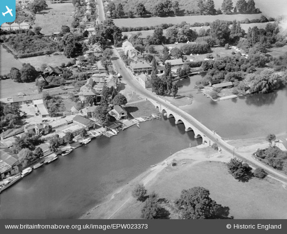
EPW023373 ENGLAND (1928). Chertsey Bridge, Chertsey, 1928
© Copyright OpenStreetMap contributors and licensed by the OpenStreetMap Foundation. 2025. Cartography is licensed as CC BY-SA.
Nearby Images (7)
EPW023373

EPW023375

EPW060395

EPW026281

EPW049235

EPW023374

EPW049230

Details
| Title | [EPW023373] Chertsey Bridge, Chertsey, 1928 |
| Reference | EPW023373 |
| Date | September-1928 |
| Link | |
| Place name | CHERTSEY |
| Parish | |
| District | |
| Country | ENGLAND |
| Easting / Northing | 505372, 166606 |
| Longitude / Latitude | -0.48546803227824, 51.388205395534 |
| National Grid Reference | TQ054666 |
Pins
Be the first to add a comment to this image!