
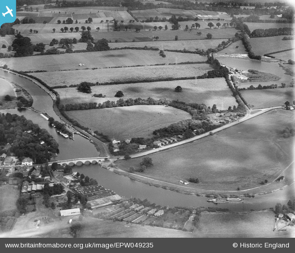
EPW049235 ENGLAND (1935). Chertsey Bridge, Chertsey Lock and the Sports Ground, Chertsey, from the south, 1935
© Copyright OpenStreetMap contributors and licensed by the OpenStreetMap Foundation. 2025. Cartography is licensed as CC BY-SA.
Nearby Images (4)
EPW049235

EPW023375

EPW023373

EPW060395

Details
| Title | [EPW049235] Chertsey Bridge, Chertsey Lock and the Sports Ground, Chertsey, from the south, 1935 |
| Reference | EPW049235 |
| Date | September-1935 |
| Link | |
| Place name | CHERTSEY |
| Parish | |
| District | |
| Country | ENGLAND |
| Easting / Northing | 505473, 166459 |
| Longitude / Latitude | -0.48406056055783, 51.386865167826 |
| National Grid Reference | TQ055665 |
Pins
Be the first to add a comment to this image!