
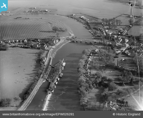
EPW026281 ENGLAND (1929). Chertsey Lock and Bridge, Chertsey, 1929
© Copyright OpenStreetMap contributors and licensed by the OpenStreetMap Foundation. 2025. Cartography is licensed as CC BY-SA.
Nearby Images (6)
EPW026281

EPW060395

EPW023374

EPW049230

EPW023373

EPW023375

Details
| Title | [EPW026281] Chertsey Lock and Bridge, Chertsey, 1929 |
| Reference | EPW026281 |
| Date | 25-April-1929 |
| Link | |
| Place name | CHERTSEY |
| Parish | |
| District | |
| Country | ENGLAND |
| Easting / Northing | 505403, 166736 |
| Longitude / Latitude | -0.48498402934172, 51.389368276377 |
| National Grid Reference | TQ054667 |
