
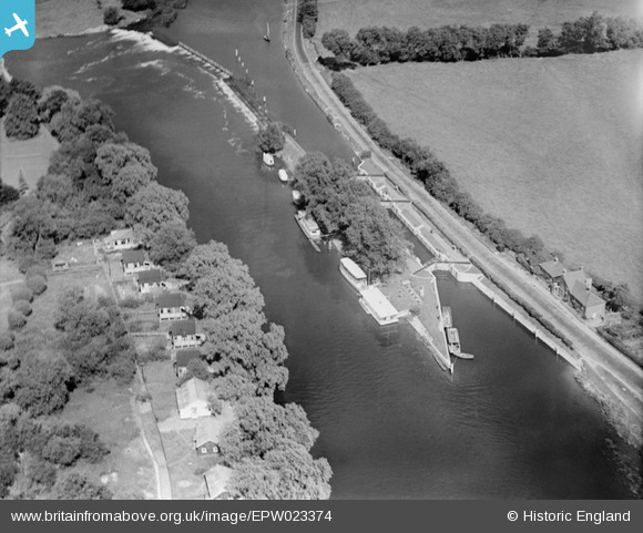
EPW023374 ENGLAND (1928). Chertsey Lock and Weir on the River Thames, Chertsey, 1928
© Copyright OpenStreetMap contributors and licensed by the OpenStreetMap Foundation. 2025. Cartography is licensed as CC BY-SA.
Nearby Images (7)
EPW023374

EPW049230

EPW026281

EPW060395

EPW023373

EPW023375

EPW026280

Details
| Title | [EPW023374] Chertsey Lock and Weir on the River Thames, Chertsey, 1928 |
| Reference | EPW023374 |
| Date | September-1928 |
| Link | |
| Place name | CHERTSEY |
| Parish | |
| District | |
| Country | ENGLAND |
| Easting / Northing | 505380, 166835 |
| Longitude / Latitude | -0.48528510530268, 51.390262512518 |
| National Grid Reference | TQ054668 |
Pins
Be the first to add a comment to this image!