
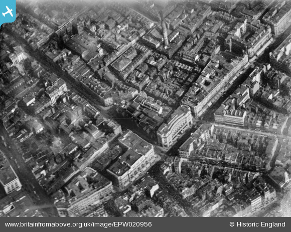
EPW020956 ENGLAND (1928). Regent Street, Westminster, 1928
© Copyright OpenStreetMap contributors and licensed by the OpenStreetMap Foundation. 2026. Cartography is licensed as CC BY-SA.
Nearby Images (31)
EPW020956

EPR000200

EPW021948

EPW021947

EPW053008

EPW020957

EPW021885

EAW000485

EPW017684

EPW045389

EPW038463

EPW039582

EPW012747

EPW021943

EPW021945

EPW046654

EPW021941

EPW055355

EPW006000

EAW050841

EPW044587

EPW005136

EAW050861

EPW021934

EAW052487

EAW050838

EAW050853

EAW052488

EPW017689

EPW045398

EAW050860

Details
| Title | [EPW020956] Regent Street, Westminster, 1928 |
| Reference | EPW020956 |
| Date | April-1928 |
| Link | |
| Place name | WESTMINSTER |
| Parish | |
| District | |
| Country | ENGLAND |
| Easting / Northing | 529161, 181060 |
| Longitude / Latitude | -0.13844213570375, 51.513199444941 |
| National Grid Reference | TQ292811 |
Pins


User Comment Contributions
Regent Street, 19/10/2015 |

Class31 |
Saturday 24th of October 2015 11:33:05 PM |