
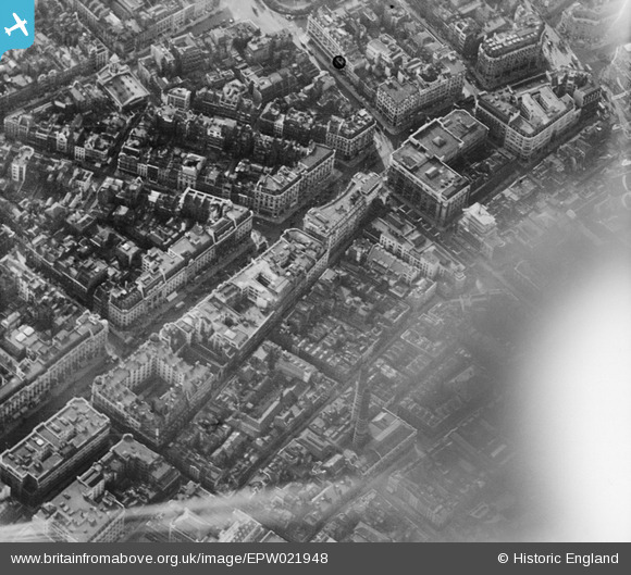
EPW021948 ENGLAND (1928). Regent Street and surroundings, Westminster, 1928
© Copyright OpenStreetMap contributors and licensed by the OpenStreetMap Foundation. 2026. Cartography is licensed as CC BY-SA.
Nearby Images (25)
EPW021948

EPW020957

EAW000485

EPW020956

EPW021947

EPR000200

EPW017684

EPW053008

EPW045389

EPW021943

EPW021941

EPW021885

EPW039582

EPR000316

EPW046654

EPW005136

EPW038463

EPW021400

EPW021946

EPW021945

EPW012747

EPW055355

EAW000483

EAW052487

EAW050838

Details
| Title | [EPW021948] Regent Street and surroundings, Westminster, 1928 |
| Reference | EPW021948 |
| Date | July-1928 |
| Link | |
| Place name | WESTMINSTER |
| Parish | |
| District | |
| Country | ENGLAND |
| Easting / Northing | 529164, 180992 |
| Longitude / Latitude | -0.13842384176952, 51.512587592891 |
| National Grid Reference | TQ292810 |
Pins

Class31 |
Tuesday 27th of May 2014 06:58:37 PM | |
|
Class31 |
Saturday 24th of May 2014 08:20:26 AM | |
|
Class31 |
Saturday 24th of May 2014 08:19:14 AM | |
|
Class31 |
Saturday 24th of May 2014 08:18:20 AM | |

Alan McFaden |
Thursday 5th of December 2013 10:26:11 AM |


