
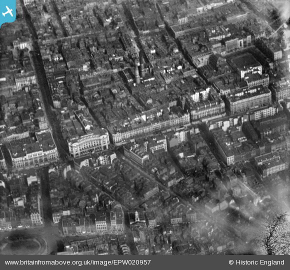
EPW020957 ENGLAND (1928). Regent Street and Golden Square, Westminster, 1928
© Copyright OpenStreetMap contributors and licensed by the OpenStreetMap Foundation. 2026. Cartography is licensed as CC BY-SA.
Nearby Images (25)
EPW020957

EAW000485

EPW021948

EPW017684

EPW045389

EPW021947

EPW021941

EPW021943

EPW020956

EPW053008

EPR000200

EPW039582

EPR000316

EPW021885

EPW021946

EPW021400

EPW005136

EPW046654

EPW038463

EPW021945

EAW048554

EPW055355

EAW000483

EAW030300

EPW021934

Details
| Title | [EPW020957] Regent Street and Golden Square, Westminster, 1928 |
| Reference | EPW020957 |
| Date | April-1928 |
| Link | |
| Place name | WESTMINSTER |
| Parish | |
| District | |
| Country | ENGLAND |
| Easting / Northing | 529157, 180951 |
| Longitude / Latitude | -0.13853969580429, 51.512220696189 |
| National Grid Reference | TQ292810 |
Pins

Class31 |
Saturday 24th of May 2014 07:41:42 AM | |
|
Class31 |
Saturday 24th of May 2014 07:40:29 AM | |
|
Class31 |
Saturday 24th of May 2014 07:39:35 AM | |

Alan McFaden |
Thursday 5th of December 2013 05:04:26 PM | |
|
Alan McFaden |
Thursday 5th of December 2013 05:03:09 PM | |
|
Alan McFaden |
Thursday 5th of December 2013 10:22:09 AM | |
|
Alan McFaden |
Saturday 4th of May 2013 03:48:54 PM |


