
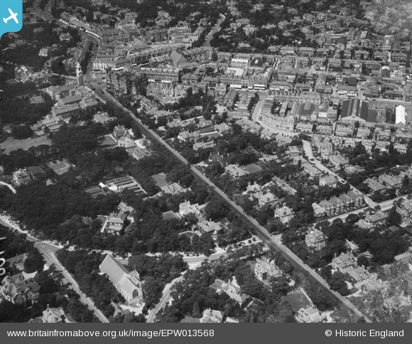
EPW013568 ENGLAND (1925). Christchurch Road, Bournemouth, 1925
© Copyright OpenStreetMap contributors and licensed by the OpenStreetMap Foundation. 2026. Cartography is licensed as CC BY-SA.
Nearby Images (8)
EPW013568

EPW018154

EPR000660

EPW013557

EPW000251

EPW037417

EPW042876

EPW046186

Details
| Title | [EPW013568] Christchurch Road, Bournemouth, 1925 |
| Reference | EPW013568 |
| Date | June-1925 |
| Link | |
| Place name | BOURNEMOUTH |
| Parish | |
| District | |
| Country | ENGLAND |
| Easting / Northing | 409781, 91426 |
| Longitude / Latitude | -1.8614228079635, 50.721802529133 |
| National Grid Reference | SZ098914 |
Pins

Class31 |
Tuesday 15th of July 2014 08:50:33 AM | |
 |
Class31 |
Tuesday 15th of July 2014 08:48:32 AM |

Peter Kazmierczak |
Sunday 15th of September 2013 04:16:29 PM | |
|
Peter Kazmierczak |
Sunday 15th of September 2013 04:15:35 PM | |
|
Peter Kazmierczak |
Sunday 15th of September 2013 04:14:45 PM | |
|
Peter Kazmierczak |
Sunday 15th of September 2013 04:13:29 PM | |
|
Peter Kazmierczak |
Sunday 15th of September 2013 04:12:55 PM | |

micky |
Monday 28th of January 2013 05:51:46 PM | |
|
micky |
Thursday 3rd of January 2013 12:09:34 PM | |
|
micky |
Wednesday 2nd of January 2013 02:41:20 PM | |
|
micky |
Wednesday 2nd of January 2013 09:10:58 AM |
