
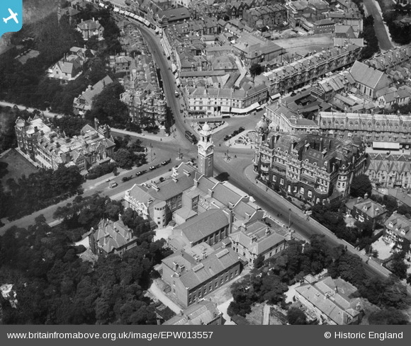
EPW013557 ENGLAND (1925). The Municipal College and Library, Bournemouth, 1925
© Copyright OpenStreetMap contributors and licensed by the OpenStreetMap Foundation. 2026. Cartography is licensed as CC BY-SA.
Nearby Images (6)
EPW013557

EPW000251

EPW037417

EPR000660

EPW018154

EPW013568

Details
| Title | [EPW013557] The Municipal College and Library, Bournemouth, 1925 |
| Reference | EPW013557 |
| Date | June-1925 |
| Link | |
| Place name | BOURNEMOUTH |
| Parish | |
| District | |
| Country | ENGLAND |
| Easting / Northing | 409560, 91352 |
| Longitude / Latitude | -1.8645558446613, 50.721140675875 |
| National Grid Reference | SZ096914 |
Pins

Watson |
Wednesday 27th of November 2013 10:48:32 AM | |

Class31 |
Monday 1st of April 2013 05:35:42 PM | |
|
Class31 |
Monday 1st of April 2013 05:35:21 PM | |
|
Class31 |
Monday 1st of April 2013 05:34:55 PM | |
|
micky |
Thursday 3rd of January 2013 07:16:42 PM | |
|
micky |
Thursday 3rd of January 2013 12:06:21 PM | |
|
micky |
Thursday 3rd of January 2013 12:04:38 PM | |
|
micky |
Thursday 3rd of January 2013 12:03:26 PM | |
|
micky |
Thursday 3rd of January 2013 12:02:53 PM |