
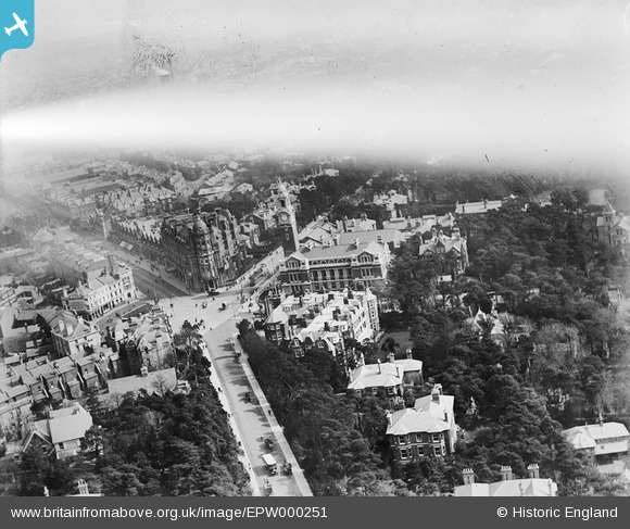
EPW000251 ENGLAND (1920). Municipal College, Bournemouth, 1920
© Copyright OpenStreetMap contributors and licensed by the OpenStreetMap Foundation. 2026. Cartography is licensed as CC BY-SA.
Nearby Images (6)
EPW000251

EPW013557

EPW037417

EPR000660

EPW018154

EPW013568

Details
| Title | [EPW000251] Municipal College, Bournemouth, 1920 |
| Reference | EPW000251 |
| Date | April-1920 |
| Link | |
| Place name | BOURNEMOUTH |
| Parish | |
| District | |
| Country | ENGLAND |
| Easting / Northing | 409560, 91348 |
| Longitude / Latitude | -1.8645559483619, 50.721104701147 |
| National Grid Reference | SZ096913 |
Pins

Peter Kazmierczak |
Sunday 15th of September 2013 04:01:26 PM | |
|
Peter Kazmierczak |
Sunday 15th of September 2013 04:00:36 PM | |
|
Peter Kazmierczak |
Sunday 15th of September 2013 03:59:44 PM | |
|
Peter Kazmierczak |
Sunday 15th of September 2013 03:58:49 PM | |
|
Peter Kazmierczak |
Sunday 15th of September 2013 03:57:57 PM |