
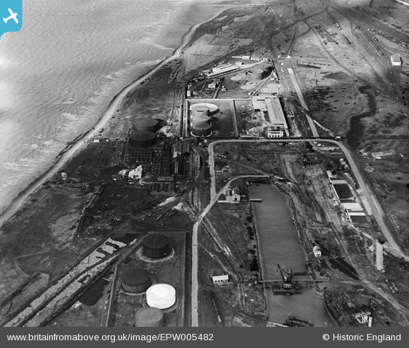
EPW005482 ENGLAND (1921). The Timber Pond and fuel storage depot, Avonmouth, 1921
© Copyright OpenStreetMap contributors and licensed by the OpenStreetMap Foundation. 2026. Cartography is licensed as CC BY-SA.
Nearby Images (10)
EPW005482

EAW002254

EPW005480

EPR000056

EAW002246

EAW002248

EPW005496

EPW005490

EPW005481

EPW005497

Details
| Title | [EPW005482] The Timber Pond and fuel storage depot, Avonmouth, 1921 |
| Reference | EPW005482 |
| Date | 20-March-1921 |
| Link | |
| Place name | AVONMOUTH |
| Parish | |
| District | |
| Country | ENGLAND |
| Easting / Northing | 351155, 179404 |
| Longitude / Latitude | -2.70392975776, 51.51096745812 |
| National Grid Reference | ST512794 |
Pins
Be the first to add a comment to this image!