
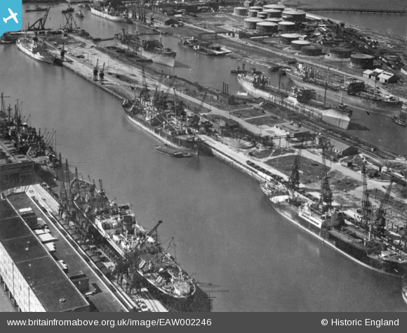
EAW002246 ENGLAND (1946). The Port of Bristol Authority Royal Edward Docks, Avonmouth, 1946. This image has been produced from a print.
© Copyright OpenStreetMap contributors and licensed by the OpenStreetMap Foundation. 2026. Cartography is licensed as CC BY-SA.
Nearby Images (11)
EAW002246

EPW005481

EPW005480

EAW002248

EAW002245

EAW002254

EPW005484

EAW002242

EAW002252

EPW005482

EAW002074

Details
| Title | [EAW002246] The Port of Bristol Authority Royal Edward Docks, Avonmouth, 1946. This image has been produced from a print. |
| Reference | EAW002246 |
| Date | 18-August-1946 |
| Link | |
| Place name | AVONMOUTH |
| Parish | |
| District | |
| Country | ENGLAND |
| Easting / Northing | 351326, 179225 |
| Longitude / Latitude | -2.7014408715856, 51.509372684103 |
| National Grid Reference | ST513792 |
