
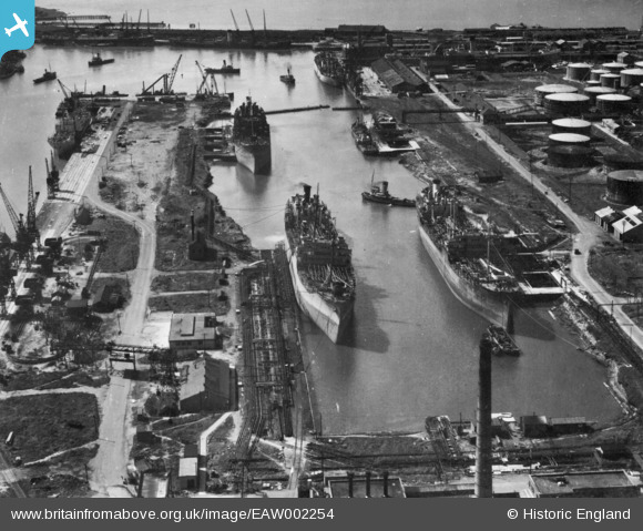
EAW002254 ENGLAND (1946). The Port of Bristol Authority Royal Edward Docks, Avonmouth, 1946. This image has been produced from a print.
© Copyright OpenStreetMap contributors and licensed by the OpenStreetMap Foundation. 2026. Cartography is licensed as CC BY-SA.
Nearby Images (13)
EAW002254

EPW005480

EAW002242

EAW002246

EAW002247

EPW005482

EPW005496

EPW005490

EPW005481

EAW002248

EPW005497

EAW002249

EAW002245

Details
| Title | [EAW002254] The Port of Bristol Authority Royal Edward Docks, Avonmouth, 1946. This image has been produced from a print. |
| Reference | EAW002254 |
| Date | 18-August-1946 |
| Link | |
| Place name | AVONMOUTH |
| Parish | |
| District | |
| Country | ENGLAND |
| Easting / Northing | 351163, 179231 |
| Longitude / Latitude | -2.703790505083, 51.509412566328 |
| National Grid Reference | ST512792 |
