
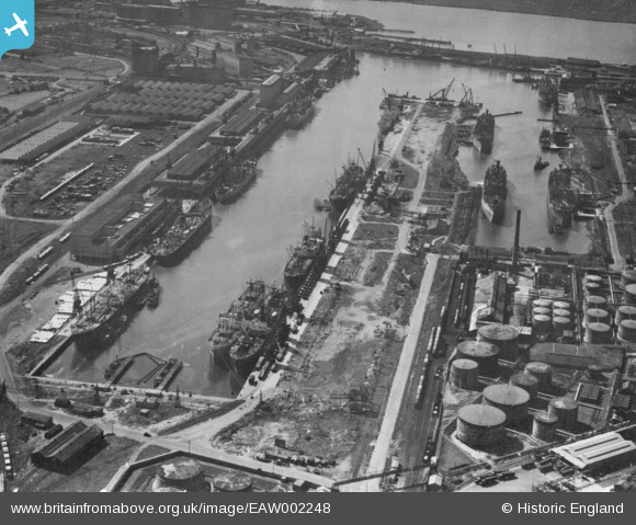
EAW002248 ENGLAND (1946). The Port of Bristol Authority Royal Edward Docks, Avonmouth, 1946. This image has been produced from a print.
© Copyright OpenStreetMap contributors and licensed by the OpenStreetMap Foundation. 2026. Cartography is licensed as CC BY-SA.
Nearby Images (13)
EAW002248

EAW002245

EPW005481

EAW002252

EAW002246

EPW005480

EPW005484

EAW002074

EAW002244

EPW005486

EAW002254

EPW005482

EAW002242

Details
| Title | [EAW002248] The Port of Bristol Authority Royal Edward Docks, Avonmouth, 1946. This image has been produced from a print. |
| Reference | EAW002248 |
| Date | 18-August-1946 |
| Link | |
| Place name | AVONMOUTH |
| Parish | |
| District | |
| Country | ENGLAND |
| Easting / Northing | 351386, 179316 |
| Longitude / Latitude | -2.7005888319867, 51.510196106449 |
| National Grid Reference | ST514793 |
Pins

MB |
Friday 22nd of January 2021 05:10:43 PM | |
|
MB |
Friday 22nd of January 2021 05:09:05 PM | |
|
MB |
Friday 22nd of January 2021 05:07:56 PM | |
|
MB |
Friday 22nd of January 2021 05:07:11 PM |