
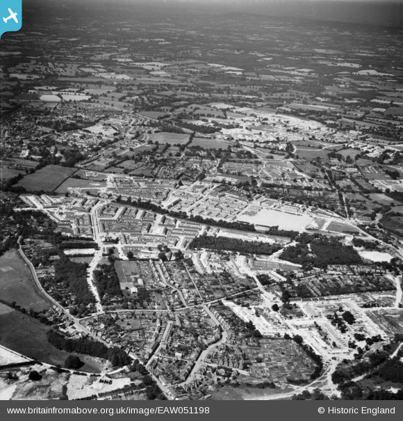
EAW051198 ENGLAND (1953). The Three Bridges and Northgate areas, Crawley, 1953
© Copyright OpenStreetMap contributors and licensed by the OpenStreetMap Foundation. 2025. Cartography is licensed as CC BY-SA.
Nearby Images (8)
EAW051198

EAW041930

EAW044434

EAW051197

EAW044436

EAW044435

EAW044438

EAW044439

Details
| Title | [EAW051198] The Three Bridges and Northgate areas, Crawley, 1953 |
| Reference | EAW051198 |
| Date | 6-August-1953 |
| Link | |
| Place name | CRAWLEY |
| Parish | |
| District | |
| Country | ENGLAND |
| Easting / Northing | 527511, 137311 |
| Longitude / Latitude | -0.17786011419761, 51.120349661304 |
| National Grid Reference | TQ275373 |
Pins
Be the first to add a comment to this image!