
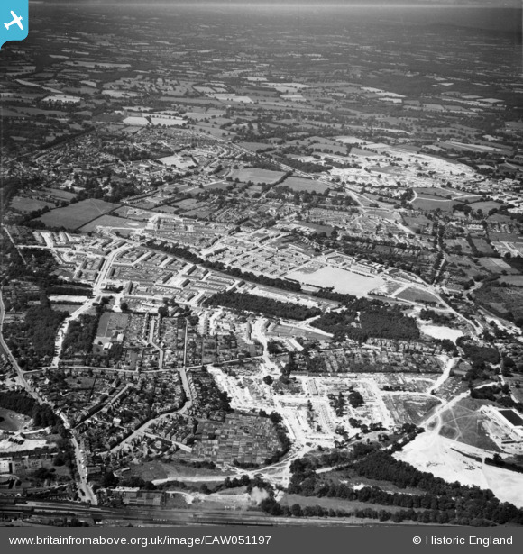
EAW051197 ENGLAND (1953). The Three Bridges and Northgate areas, Crawley, 1953
© Copyright OpenStreetMap contributors and licensed by the OpenStreetMap Foundation. 2025. Cartography is licensed as CC BY-SA.
Nearby Images (7)
EAW051197

EAW044434

EAW044435

EAW041930

EAW051198

EAW044436

EAW044438

Details
| Title | [EAW051197] The Three Bridges and Northgate areas, Crawley, 1953 |
| Reference | EAW051197 |
| Date | 6-August-1953 |
| Link | |
| Place name | CRAWLEY |
| Parish | |
| District | |
| Country | ENGLAND |
| Easting / Northing | 527637, 137331 |
| Longitude / Latitude | -0.17605346232123, 51.12050136984 |
| National Grid Reference | TQ276373 |
Pins
Be the first to add a comment to this image!