
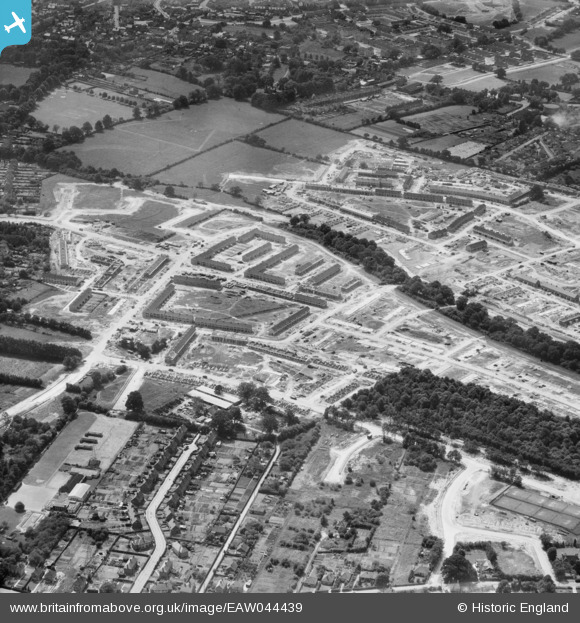
EAW044439 ENGLAND (1952). New housing under construction on either side of Northgate Avenue, Crawley, 1952
© Copyright OpenStreetMap contributors and licensed by the OpenStreetMap Foundation. 2025. Cartography is licensed as CC BY-SA.
Nearby Images (5)
EAW044439

EAW044438

EAW044435

EAW044436

EAW051198

Details
| Title | [EAW044439] New housing under construction on either side of Northgate Avenue, Crawley, 1952 |
| Reference | EAW044439 |
| Date | 27-June-1952 |
| Link | |
| Place name | CRAWLEY |
| Parish | |
| District | |
| Country | ENGLAND |
| Easting / Northing | 527746, 137071 |
| Longitude / Latitude | -0.17458881506751, 51.118140055162 |
| National Grid Reference | TQ277371 |
Pins
Be the first to add a comment to this image!